Local guide
Read the water.
The bay runs on a schedule. Learn it and everything gets better: the kayaking, the beach walks, the tidepools.
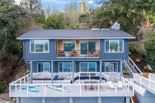
The water in front of the house is never the same twice. On the biggest exchange days the swing from high water to low water tops ten feet, and the beach goes from a narrow strip to a wide flat and back again in about six hours. Guests who check the tide table get more beach, calmer paddling, and tidepools. Guests who do not still have a great time, but they miss the good stuff.
How the tides work here
Puget Sound has mixed tides: two high tides and two low tides most days, and the two highs are different heights, just like the two lows. One low might be a gentle two feet, the next one a minus two that exposes everything. That uneven rhythm is the whole game. The tide chart looks lopsided because it is.
The practical upshot: never assume today's pattern matches yesterday's. The whole cycle slides about an hour later each day. Check the table every morning the way you check the weather.
Which table to check
Use NOAA's tide predictions for Gig Harbor, station 9446369. It is the closest published station to the house, about six miles away across the water, and it is close enough for planning your day. The Seattle station, 9447130, is the regional reference the local predictions are built from. Either one tells you what you need: the times of the highs and lows, and how big the swing is.
Bookmark the Gig Harbor page on your phone on day one. You will open it more than the weather app.
Minus tides and the beach
Look for negative numbers on the low tide line. A minus tide means the water drops below the chart's zero line and pulls far back off the beach, exposing rock and pools that are underwater the rest of the time. In late spring and summer these often land in the morning, which is the best tidepooling of the year: daylight, calm water, and the whole intertidal zone laid out.
Walk the waterline slowly and look down. Ochre sea stars in orange and purple, green anemones closed up like olives, small crabs in the pools, moon snail shells the size of your fist. It is all right there off the private beach. You do not need to drive anywhere.
If you want a second spot, Owen Beach at Point Defiance Park, 35 minutes away in Tacoma, is excellent at low water too.
Look, don't take
This part matters. Wet your hands before you touch anything, step only on bare rock, and put every rock back exactly where you found it. Do not pry animals off the rock. Do not take shells with animals still in them. The tidepool is someone's whole world, and it has to survive until the water comes back.
One factual note: taking shellfish or anything else from the intertidal zone requires a Washington shellfish/seaweed license from WDFW. This guide is look-only, which needs no license at all.

Tides and the kayak
The hour around the tide change is called slack water, and it is the easiest paddling: the water goes quiet before it turns around. Mid-ebb and mid-flood are the opposite. That is when Colvos Passage moves real water, and the passage is the deep channel right out front.
NOAA runs a current prediction station almost on our doorstep: Anderson Point, station PUG1518, about a mile north of the house. It publishes predicted max ebb, max flood, and slack times. If you plan to cross the passage, check it first. If you are staying in the bay, you can mostly ignore all of this. Read the full kayaking guide for where to paddle.
Timing your beach walks
Low tide gives you the most beach. That is also when the seals haul out on the rocks and the otters work the shoreline, so a low-tide walk doubles as a wildlife walk. Mornings are best: low water, calm air, animals out.
One safety note that applies everywhere on Puget Sound. The tide comes back over the low flats first, which means the path you walked out on can flood before the ground you are standing on does. Keep an eye on the turn, give yourself plenty of time, and never get so absorbed in a tidepool that you forget the water is coming back.
Questions people ask
- When is low tide in Olalla Bay?
- It changes every day, sliding about an hour later each day. Check NOAA's Gig Harbor station, 9446369, for your dates. That is the closest station to the house.
- What is a minus tide?
- A low tide predicted below the zero line on the chart. The water pulls far back and exposes the most beach and tidepools. In late spring and summer they often land in the morning.
- Is it safe to kayak in Colvos Passage at peak current?
- Mid-ebb and mid-flood move real water through the passage. Paddle near slack water instead, and check NOAA's Anderson Point current station, PUG1518, before crossing.
- Can we pick up the sea stars?
- Look, do not lift. Wet hands, bare rock only, and put everything back where you found it.
- Where is the best tidepooling near the house?
- The private beach at a minus tide. Owen Beach at Point Defiance, 35 minutes away, is the best public backup.